Could Satellites Change Systems for Farming and Aquaculture?
ANALYSIS - Developments in satellite, space and tracking technology are starting to have repercussions far beyond field mapping for crops and GPS guidance systems for farm machinery. 19 October 2015
 5 minute read
This new technology is now touching all aspects of food production from livestock and arable farming to aquaculture and along the food production chain through the processor to the consumer.
According to Dave Ross, senior researcher at the Scottish Rural College, SRUC, speaking at the Satellites for Agri-Food Consortia Building Workshop in London, satellite technology could play an important role in meeting “the perennial food problem of the increasing population”.
“One of the solutions to this is looking at technology that looks at sustainable crop, food and livestock production – sensing systems to accurately monitor all aspects of the food chain,” he said.
He said that satellite technology can help in improvements in the yield and sustainability of crop and livestock food products by producing data on the variation in production with sensing systems to accurately monitor aspects of the production system, the acquisition of data and the conversion of this data into information.
This will produce effective crop and livestock production management with production efficiency, better livestock health, sustainability and supply chain compliance, traceability and provenance.
While satellite technology has been an integral part of the cereal and crop sector for some time with precision farming a major element in the concept, other sectors of the food, farming and aquaculture sectors are now looking at the potential the technology offers.
In the cereal and crop sectors, satellites have been used to map fields, monitor and measure soils, help increase yields and cropping densities, understand nutrient imbalances and deficiencies, monitor suboptimal plants and understand and trace irrigation needs and flood risks.
The technology has also been used to monitor weeds and pest movements and crop losses.
Much of this information and these measurements have been gleaned using the European Space Agency’s Sentinel series of satellites orbiting the earth.
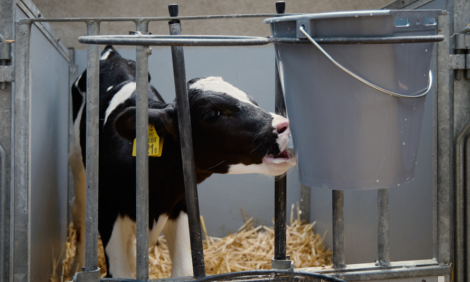
However, according to Mr Ross, the capabilities of this satellite system can also help in livestock farming.
The information from the satellites can be used in field monitoring of herd behaviour and livestock tracking and tracing.
It can become an essential part of traceability in the supply chain with both complete herd and flock monitoring and tracking of individual animals.
Through checking livestock movements, it can help in assessing herd health, numbers and feeding habits.
It can help in checking isolation behaviour and identify parturition.
The information received can also identify sub-herd activity and social hierarchies as well as pasture use.
The data received from the satellites can also help monitor grazed area biomass and indicate feed habits and pasture quality.
Mr Ross said that the systems could be used to remotely monitor losses of livestock.
A study on severe lamb losses, “black loss”, in parts of Scotland conducted by the Highlands and Islands Sheep Health Association had found that up to 18.5 per cent of the lambs had disappeared through predators and illness and remote monitoring could help to reduce these losses and the financial loss that accompanies them.
He added that the technology is now being used in Kenya to assist in insurance claims for livestock losses caused through drought.
He said that insurance had not been an option for herders in Northern Kenya, because the insurance companies refused to go to the expense to justify claims by traveling great distances to count dead animals in the cases of drought related deaths.
However, satellite imagery was deployed to assess pasture health and to pay out claims when the images confirmed severe drought conditions.
He said a report on the situation described this use as: “An inspiring application of remote sensing technology to aid in economic development and to deliver a practical solution that makes sound business sense.”
In other areas, data received from satellites has been used to monitor the spread of diseases and help prevent the spread by monitoring animal movements to prevent contact spread. The data can also be used to build models that would show the potential for the spread of diseases to enable precautionary measures to be put in place.
In the aquaculture sector, the ability of satellites, such as the Sentinel series, to map not only land but oceans can give fish farms the information necessary to monitor algae blooms and jellyfish blooms that cause gill damage, depletion of oxygen and taints.
The technology can also detect chlorophyll production, which is an indication of ecosystem productivity for shellfish farming.
It can also help in weather forecasting and monitoring of sea conditions.
Mr Ross said that satellite data can be used in the aquaculture industry for thermal and current imaging in assisting in site selection for fish farms and shell fish farms.
As fish farms are often in remote environments satellites can be used in communications, remote sensing and data networks as well as exploring aquaculture interaction with the environment and animal tracking.
It can give measurements of greenhouse gases in soil and oceans and give indications of ecosystems for the best shellfish production.
Mr Ross added that for the aquaculture sector in particular, the satellite systems that are already available could be used by integrating imaging tools into future regulatory and planning systems and provide “aspirational strategies for satellite based technology to deliver step changes to existing infrastructure”.
The workshop was the launch pad for a nationwide initiative and funding competition to find new concepts and uses for the data and technology available from existing and proposed satellites.
The aim of the competition is to stimulate the development and adoption of new technologies and business models based on the innovative use of satellite technology to improve the productivity of the UK food and farming industries, while addressing the environmental impacts of increased land use and intensification.
The projects have to be led by a business and have to be collaborative.
Small businesses could receive up to 45 per cent of their project costs, medium sized businesses 35 per cent and large businesses 25 per cent.
In all, £3.75 million is available from Innovate UK and the Natural Environment Research Council, with up to £750,000 in funds going to smaller-scale technical feasibility studies and the collaborative projects of up to £1 million sharing the remainder.
The competition opens on 16 November. More information about the competition can be found here.